
Coral Conservation & FOFR Resources
Links to further resources for your viewing and learning pleasure.
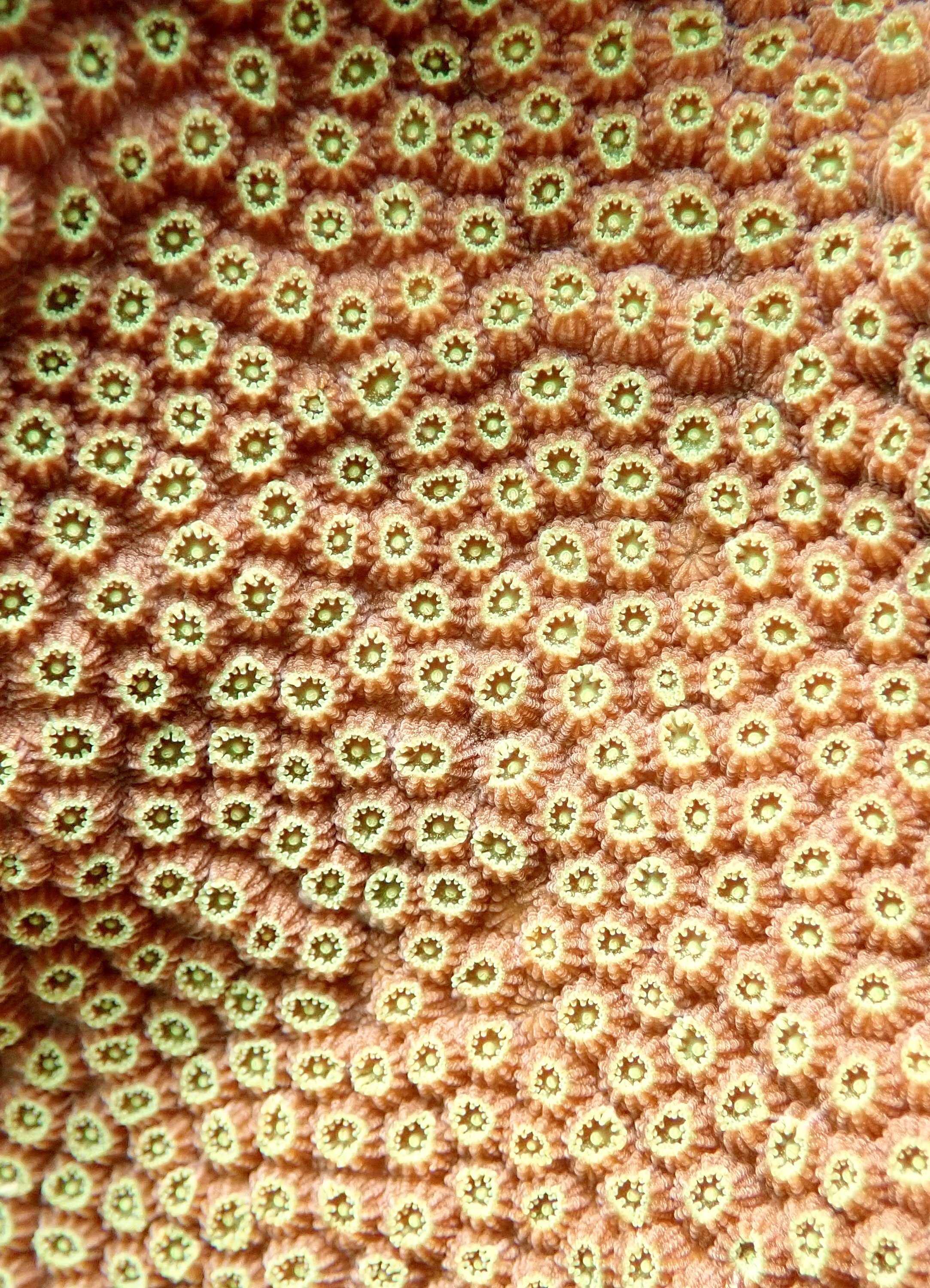
Florida Coral Reef Maps
Florida’s Coral Reef

Southeast Florida Coral Reef Ecosystem Conservation Area now known as the Kristin Jacobs Coral Reef Ecosystem Conservation Area

Take a Virtual Aerial Tour of the 100+ Mile Kristin Jacobs Coral Reef Ecosystem Conservation Area with the video below!
Courtesy of NSU Oceanographic Institute & National Coral Reef Institute (Dr. Brian K. Walker, Ph.D.)
Kristin Jacobs Coral Aquatic Preserve
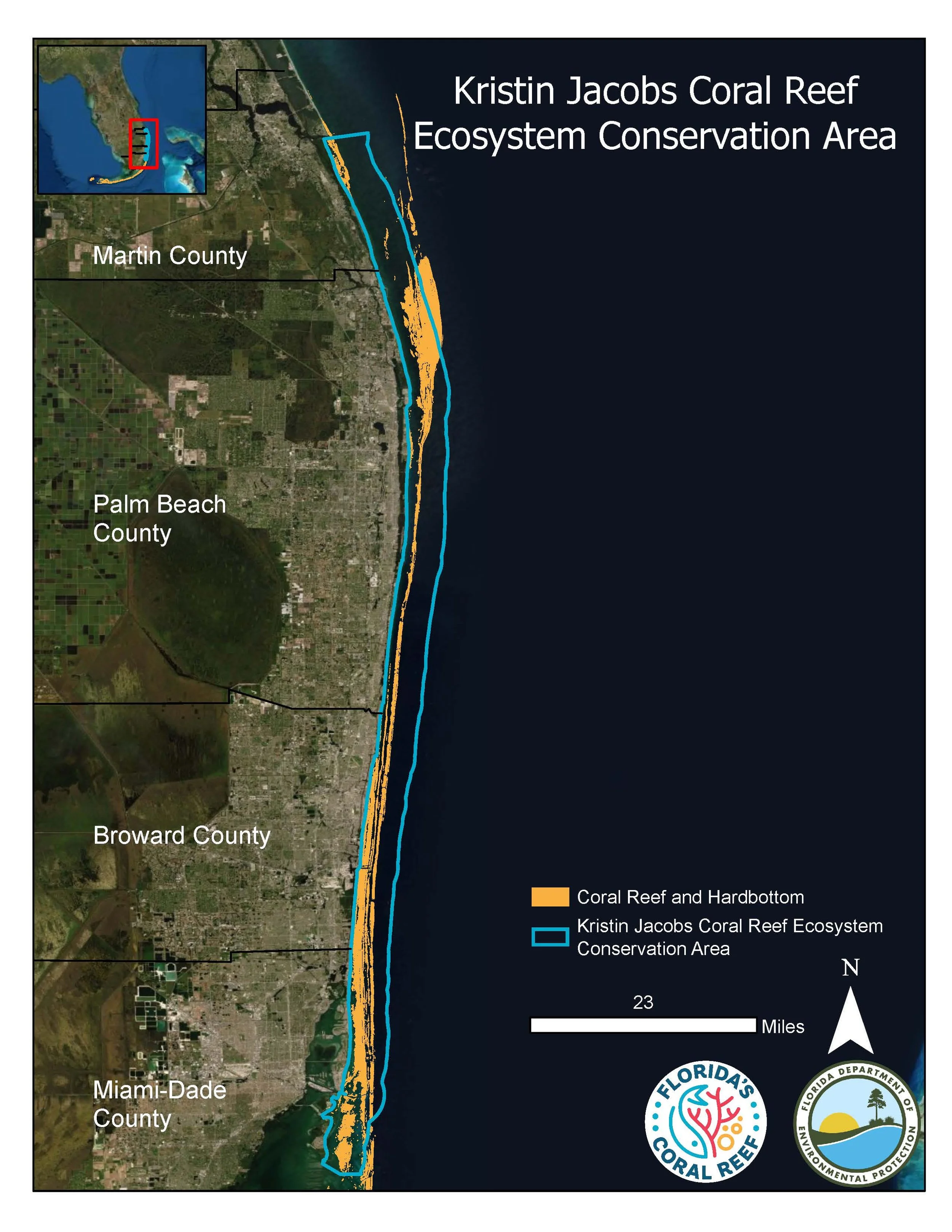
The Kristin Jacobs Coral Aquatic Preserve, formally known as the Kristin Jacobs Ecological Conservation Area, is the area of reef FOFR helps support, which is managed by the DEP’s Coral Reef Conservation Program (CRCP) and the Coral Protection and Restoration (CPR) program. It’s 100+ mile stretch of reef that stretches from the northern Biscayne Bay boundary to St. Lucie Inlet in Martin county.
Below you can find the Kristin Jacobs Coral Aquatic Preserve management plan draft. The DEP is hosting meetings this month to get the public’s input on how to manage the new preserve (received AP designation in 2024).

FOFR YouTube Webinar Series

Learn about the following topics:
Florida Coral Reef Webinar Series: Marine Invertebrate Identification Part One of Two
Florida Coral Reef Webinar Series: Marine Invertebrate Identification Part Two of Two
Florida Coral Reef Webinar Series: Reef Fish Identification - Part One
Florida Coral Reef Webinar Series: Reef Fish Identification - Part Two
Florida DEP Coral Reef Conservation Program
This is the specific program at the Florida DEP that FOFR supports, managing the northern section of the reef from St. Lucie Inlet to the northern border of Biscayne National Park.
For a list of the Florida DEP’s citizen support organizations, click here.


Florida’s Coral Reef
Powered by the Florida DEP to protect all reefs from the western most point of Dry Tortugas, through the Florida Keys, Miami, and up to its northernmost point at St. Lucie Inlet in Martin County.

Likeminded Organizations FOFR Supports
Aquatic Preserve Society (Statewide)
Estero Bay Buddies (Estero Bay Aquatic Preserve)
Friends of the GTM research Reserve (Guana Tolomato Matanzas National Estuarine Reserve)
Friends of Our Florida Reefs (over 100-miles of SE Florida Coral Reefs above Biscayne Nation Park)
Friends of the Reserve (Apalachicola National Estuarine Research Reserve)
Friends of the Spoil Islands (Indian River Lagoon Aquatic Preserve Spoil Islands)
Northwest Florida Aquatic Preserves (aka: Ecosystem Restoration Support Organization)
Follow FOFR on Socials
-

Facebook
-

Instagram
Ways to Join the Coral Conservation Cause!
-
Membership
-
SEAFAN
-
Resources
-
Donate